
Mapping the Scene
What once took a measuring tape, multiple officers and hours on the scene is now a one to two-officer job in half the time as agencies are trading in old-time tools for modern technology in accident and crime scene mapping.
To paint the picture for investigators and juries, crime scenes typically have three modes of documentation: written, photographic and sketch, according to Kentucky Department of Criminal Justice Training Special Topics Section Supervisor Larry Sennett. Advanced crime-scene-mapping tools such as total stations and 3D scanners provide detailed sketches that show everything in the image in relationship to each other, supplement photographs and give enough information to recreate the scene if needed.
“You can’t get a whole scene in a picture, but you can in a sketch,” said Sennett. “When it goes to court, your jury was not at the scene. So, you have to bring the scene to the jury.”
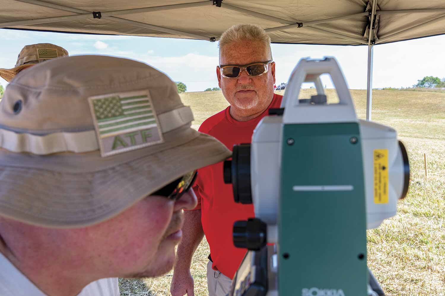
One of the most popular tools of the crime scene-mapping trade, based on its versatility and price range, is the total station.
Traditionally used by surveyors and archeologists, the electronic optical device reads slopes, provides elevation and northing and easting coordinates, and measures angles and distances.
Introduced to law enforcement in the 1990s, as a way to clear crash scenes swiftly, total stations typically require two individuals to operate with one running the device situated on a tripod and another holding and moving a prism pole, to which the machine shoots one point per shot.
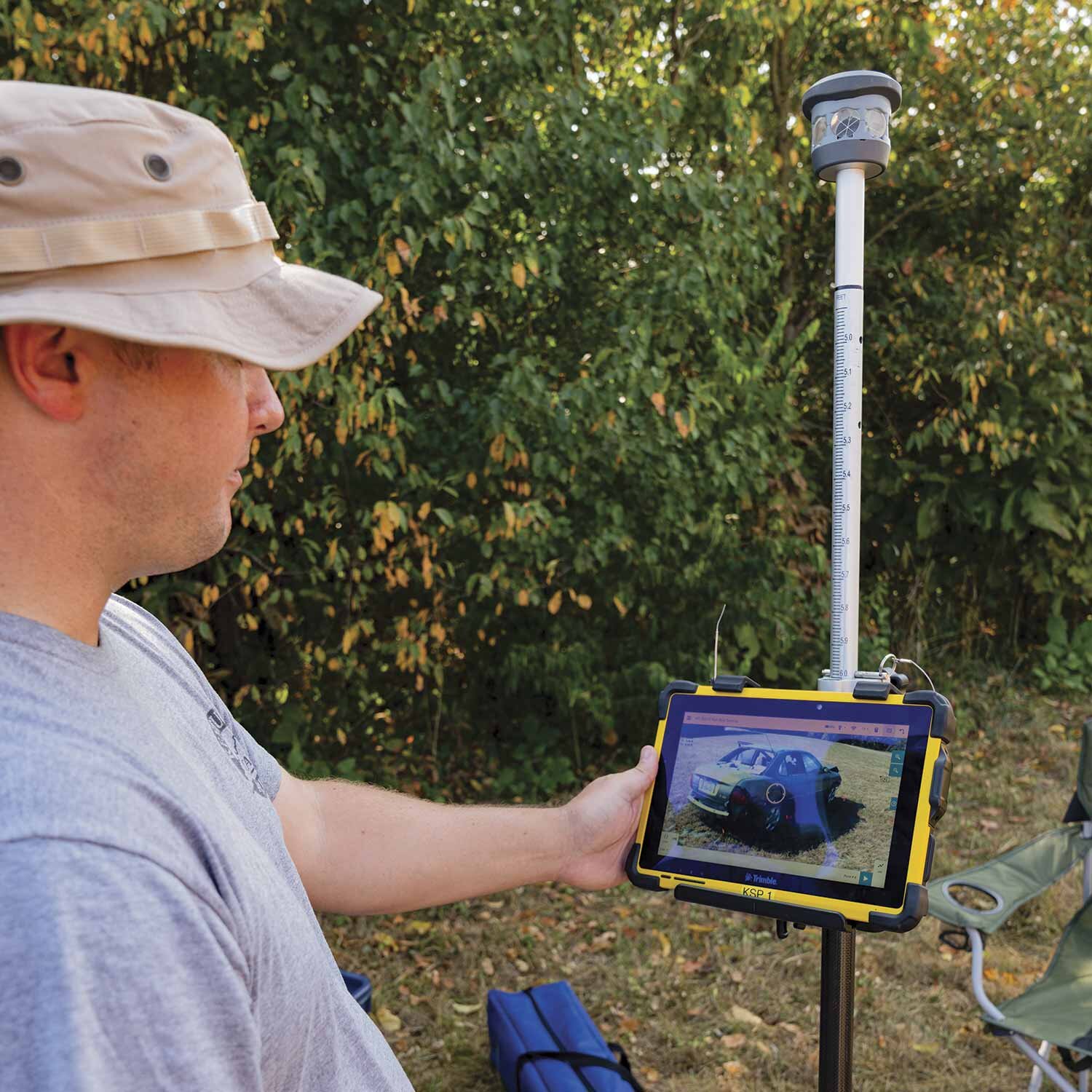
“Look at it like this, the prism pole is the pencil that draws the scene,” explained Sennett. “The total station is recording that information.”
That information is then processed through computer software to create the sketch, which can be viewed in 2D or altered into a 3D rendering.
Even more advanced, 3D laser scanners can shoot hundreds of thousands of points per second by spinning 360 degrees on the X-and Y-axis, producing coordinates and measurements with significantly increased speed, according to Kentucky State Police Trooper Jack Hedges.
Hedges, a member of KSP’s Critical Incident Response Team, said his agency added the scanner to their arsenal in 2012. “The scene will dictate what (tool) you use,” said Hedges, noting KSP still uses total stations as well since each machine offers benefits and drawbacks.
Total stations, he explained, are often chosen for crash scenes when measuring long distances from one spot and their affordability (often more than $20,000 cheaper than a 3D scanner). However, 3D laser scanners can capture more data at once; can be operated by a single officer and shine in mapping indoor crime scenes.
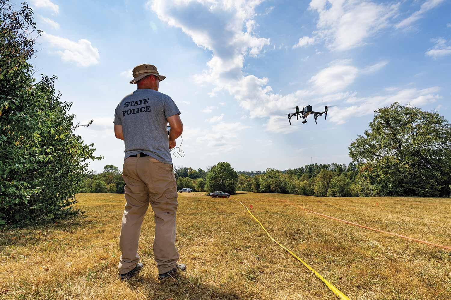
KSP has also enlisted the use of drones in scene mapping, which expedites the process through photogrammetry. Hedges explained the drone is flown in specific patterns capturing hundreds of photographs, which are input into the software. The software then generates a point cloud, a collection of data points defined by a specific coordinates system, by running algorithms based on pixels, angles and GPS.
Drone work will require a powerful computer and a tech-savvy officer to run the device. Still, having one can greatly aid in quickly mapping an interstate crash to allowing transportation to continue since data collection can be as short as 15 to 30 minutes, depending on the scene, Hedges noted.
“The beauty of the drone is that you can get images and mapping aspects from the air,” elaborated Sennett. “You will be able to see things that you wouldn’t be able to map otherwise, especially like largescale disasters.”
Regardless of what device a department chooses, both experts acknowledged the benefits modern mapping systems have had on investigations and policing.
“It’s big,” said Hedges. “It’s the CSI effect that juries are familiar with…That’s who we are keeping in mind from the beginning of our call out to preparing a case for court. The ultimate perspective we want to think about is the jury’s. (These tools) capture the crime scene and give us the ability to put a juror in any spot they need to be to see what happened.”
By being able to show what can be seen from any point of a scene, these tools can corroborate or refute statements made to police and courts, Sennett added.
To improve ease of use and precision, Sennett urged operators to practice for perfection.
DOCJT offers a 40-hour Forensic Mapping course where students are taught how to use a total station, as well as mapping and drawing software. For more information, visit DOCJT.ky.gov and click on the Training link. A block of DOCJT’s Kentucky Criminalistics Academy also covers forensic mapping during the first five weeks. During the second phase of the academy, students will dig even deeper into the use of technology and skills in various situations.


